Development of Service “Aero Remote Soil Analysis and Consultations” (InoDAT)
Wat was de uitdaging/het probleem dat werd aangepakt??
Soil analysis is not very popular in Lithuania. The situation has slightly changed in recent years as the number of young farmers increases in the country. More young farmers become interested in precision farming and innovative solutions for the modernization of their farms. Dus, farmers tend to use modern methods of farming and seek more effective use of resources. Large production farms use soil analysis services as well.
The tendency of chemicalization is noticed in agriculture nowadays to produce higher yields. The focus is on the increase of productivity regardless of the fact that some methods used to increase productivity have an influence on the degradation of soil. Soil soaking, compressibility, erosion, and content of humus are the main elements of quality of soil strongly related to principles of precision agriculture.
Farmers felt a need for the development of service of remote sensing of soil physical parameters for a reasonable price. EIP operational group was formed to achieve coherence between the needs of farmers and the experience of researchers and advisors to develop an innovative service Aeroremote soil analysis and services (InoDAT). The aim was to develop a technology based on data of the unmanned aerial vehicle and soil studies which would allow providing farmers a service ensuring that crop problems were dealt with effectively and on time and optimal solutions for dealing with these problems were offered. The new service made the soil analysis of a lower price.
Hoe heb je het probleem opgelost??
EIP operational group members of which were researchers of Vilnius University (Institute of Geosciences), experimental farms, boeren, and specialists of Lithuanian Agricultural Advisory Service was formed. The aim of the group was to develop, test, and apply new knowledge in practice which would allow to remotely identify the main factors that determine or limit the fertility of the soil. The condition of the soil was evaluated using aero photo images. Such remote sensing observation was of a reasonable price. Specialists of the Institute of Geosciences of Vilnius University had the experience of landscape studies and research in material components forming landscape (including the soil), analyse, and interpretation of results of research. In aanvulling op, specialists of the Lithuanian Agricultural Advisory Service had expertise in the provision of analytical consultations and it allowed scientific innovations to be applied in practice.
An innovative service was developed which allowed to remotely identify humus content in the soil, level of soil erosion, level of soil humidity, the granulometric composition of the soil, and aggregate soil structure using aero photo images made by unmanned aerial vehicles and terrestrial soil characteristics.
Advisors were taught to operate unmanned aerial vehicles, use algorithms provided by researchers, to interpret and analyze them. Algorithms for the identification of physical characteristics of soil were proposed based on aero photo images.
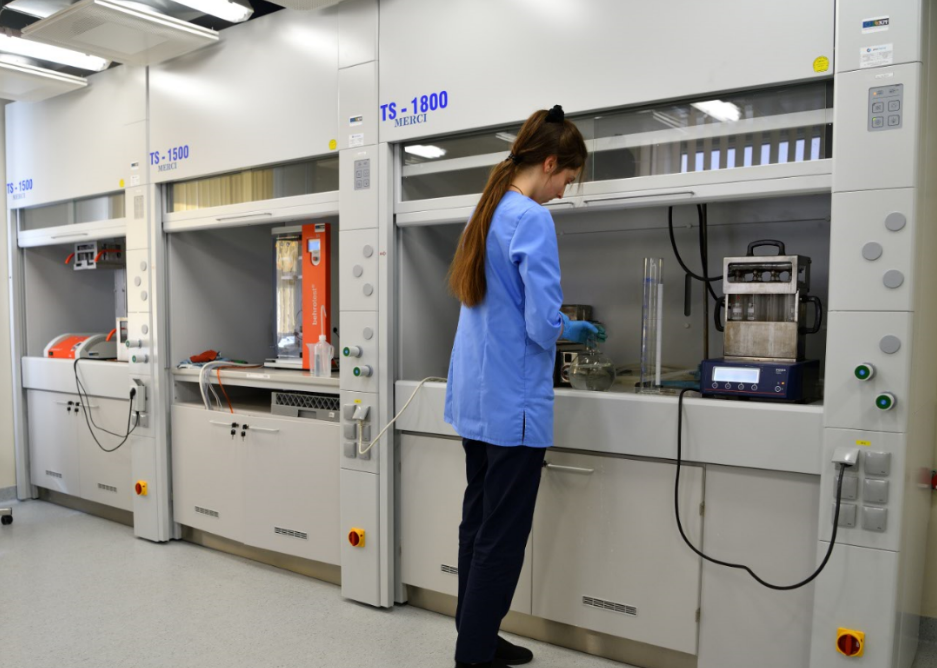
Operation reliability of the algorithms was tested using programs ArcGis, Agisoft, and eCognition.
A methodology for the provision of new service was prepared.
A standard of provision of new service was prepared.
Identification of factors determining or limiting fertility of soil and changes of soil encouraged farmers to evaluate the effectiveness and economic results of their farms, helped farmers to make effective decisions and improvements of physical and chemical parameters of soil reducing leaching of nutrients and fostering farmers to effectively use fertilizers.
The new service helped farmers to improve the processes of crop maintenance, accounting, and evaluation of the condition of the soil. The provision of this service helped farmers to optimize the use of necessary substances which has a significant influence on the reduction of production costs, an increase of crop yield, and incomes.
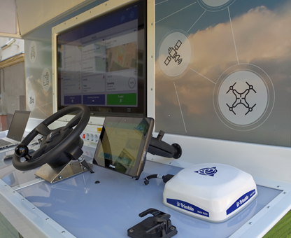
A specialized aerial unmanned vehicle was purchased. Using the device, it is possible to monitor the area radius of which is 2 kilometers, and take photos of a resolution of 14 megapixels. Data were directly transferred to a pilot of the aerial unmanned vehicle. A farmer using this technique was able to monitor his parcels in real-time, evaluate the condition of his crop, and make decisions on how to improve the condition of soil or crop in specific areas of parcels. This allowed optimizing costs.
Wat zijn de succesfactoren bij het oplossen van het probleem??
Collaboration between researchers and farmers as well as advisors led to the successful implementation of the project. Researchers made a significant contribution to the preparation of algorithms, methodological recommendations, and interpretation of data provided by the aerial unmanned vehicle.
Seminars on farms (meer dan 22 farms) were organized to demonstrate the applicability of project results on farms. Farmers were willing to take part in project activities and gain new knowledge.
The wide experience of specialists of LAAS in filling in and submitting applications and leading projects was one of the key factors in the successful implementation of the project.
Researchers of Vilnius University had relevant experience of 10 years in studies of physical and chemical characteristics of the soil. The choice of project partners (d.w.z. boeren) was made taking into consideration the recommendations of researchers. Farms were chosen from different territories of the country to represent various ecosystems of plains and highlands and their typical problems. There usually are problems of soil soaking, humus content, and problems of compressibility of soil in plains. Highlands are problematic because of soil erosion and the uneven distribution of humus caused by soil erosion.
Onverwacht mislukt, indien van toepassing
We did everything just right!
Les geleerd
The project was a multi-actor one. Results of the project were achieved in collaboration with farmers, adviseurs, and researchers. Reasonable discussions among partners were one of the factors of a successful implementation of the project. Partners had to learn to listen to each other in order to come up with desired results.
Farmers had different experiences in using innovations on their farms. Dus, the methods of the use of innovative technologies had to be precisely explained to farmers by researchers and advisors.
Welke rol speelt de adviseur of adviesdienst binnen de praktijkcase?
Litouwse landbouwadviesdienst (LAATSTE) is the main partner of the project responsible for coordination and administration of project activities, preparation of tender, application of project results in practice (d.w.z. on farms), communication and collaboration with project partners, and dissemination of project results.
LAAS has provided services of soil analysis since 1993. Special attention was paid to the development and improvement of services related to soil. Soil samples were taken from farms by crop specialists. Vervolgens, samples were analyzed by specialists of the laboratory of precision farming.
Advisors of LAAS are in close relation with their clients (boeren) therefore, they played a significant role in the project as they helped to find farmers from different geographical zones of the country who would be interested in and willing to take part in project activities. Advisors helped researchers to transfer information and requirements to farmers to ensure the implementation of soil studies to be as precise as possible.
Kan jouw aanpak worden overgedragen en/of aangepast voor andere innovatie-uitdagingen en regio's??
Ja
Geschatte overdraagbaarheid op een schaal van 1 naar 5
(waar 1 is gemakkelijk en 5 erg moeilijk)
3
Voor het delen van de ervaring op de goede praktijk, please contact Rimtautas Petraitis (rimtautas.petraitis[Bij]lzukt.lt)
Find more about the project on www.lzukt.lt